.jpg)


- Out-of-Stock


To allow adventurers to keep in touch and stay on the right path, they will, the Montana 700i handheld device combines the flexibility of on-road and off-road navigation with messaging functions worldwide and interactive SOS via inReach satellite technology.
 Security policy
Click here to be redirected to our FAQ page
 Return policy
Click here to be redirected to our FAQ page
 Delivery policy
Click here to be redirected to our FAQ page

Guarantee safe & secure checkout
To help adventurers stay in touch and stay on track, the Montana 700i wearable combines the flexibility of on- or off-road navigation with worldwide messaging and interactive SOS features via technology inReach satellite.
A great novelty. A full AZERTY keyboard lets you easily enter messages.
Go further while staying in touch with inReach messaging and 24/7 SOS.
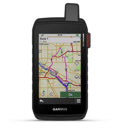
TopoActive Canada maps with route generation. You can now choose between off-road or on-road navigation.
Meets MIL-STD 810 for resistance to extreme temperatures, shock, water and vibration.
Get a clear perspective of BirdsEye satellite images right on your device.
Maximize your adventures with over 18 hours of battery life with the lithium-ion battery in GPS mode.
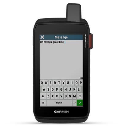
Exchange text messages with loved ones at home, post to social media, or communicate with other inReach devices in the field (active satellite subscription required).
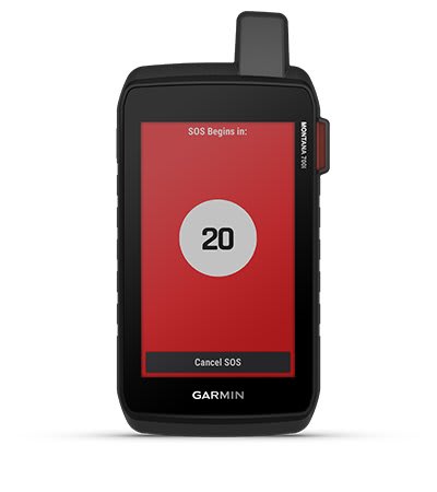
In the event of an emergency, send an interactive SOS to Garmin Response℠, a 24/7 emergency response coordination center (satellite subscription required).
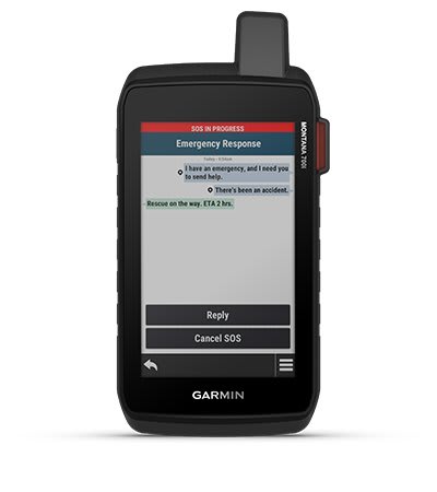
Instead of going through the cellular network, your messages, SOS and tracking data are now transferred via the global Iridium® satellite network (active satellite subscription required).
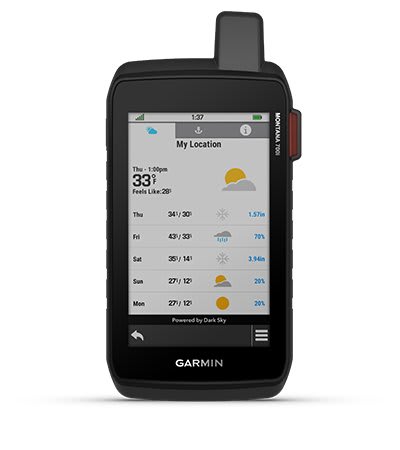
The available InReach weather forecast service delivers detailed updates directly to your Montana wearable or paired devices, so you know what to expect on the road.
This durable, waterproof handheld device is tested to U.S. military standards and features a 5-inch touchscreen compatible with gloves, which is 50% larger than previous Montana models.
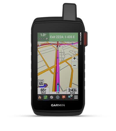
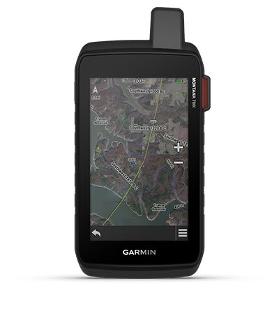
Easily switch from trail to road navigation with City Navigator's preloaded street mapping, which provides direction your driving with easy-to-follow voice guidance.
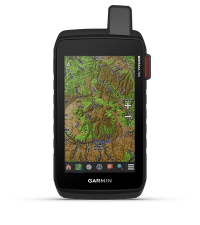
To orient yourself on all your adventures, use the preloaded TopoActive Canada maps. View elevation, coastlines, rivers, landmarks and more.
Download Birdseye Satellite Images (no annual subscription required) directly to the product to display realistic views and create waypoints based on geographical markers.
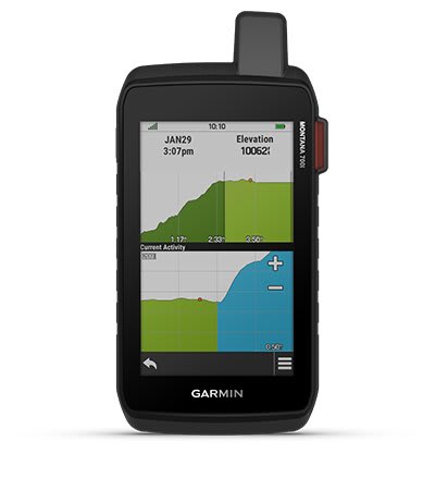
Track your next route with ABC sensors including an altimeter for altitude data, a barometer to monitor the weather and a 3-axis electronic compass.
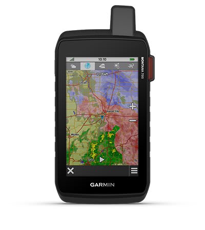
Use cellular connectivity to access the latest dynamic weather forecasts through the Garmin Connect app.
For hunters and dog trainers, the Montana syncs with compatible Astro® or Alpha® series handheld devices
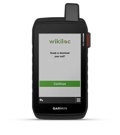
This preloaded app lets you easily download Wikiloc hiking, biking, and other trails shared by outdoor enthusiasts like you. For 60 days, try Wikiloc Premium for free as wellas other exclusive features.

Specific References
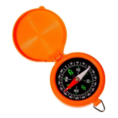
Easy to Read Display
Built-in Digital Compass With Temperature, Time, Barometric Pressure, and Elevation.
Provides the Best day or times of day to Hunt or Fish based on moon phases
Glove Friendly Buttons
Includes tether and carabiner to connect to your backpack, belt or jacket.
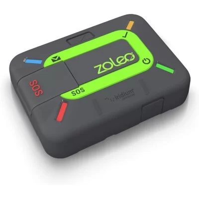
ZOLEO Connect ensures seamless communication no matter where you are. With advanced satellite technology, it allows you to send texts, emails, and SOS alerts even in the most remote areas. Stay connected, stay safe with ZOLEO Connect.
This compact satellite communication beacon allows you to stay close to your family when you're not connected, for total peace of mind with every adventure, without weighing yourself down.
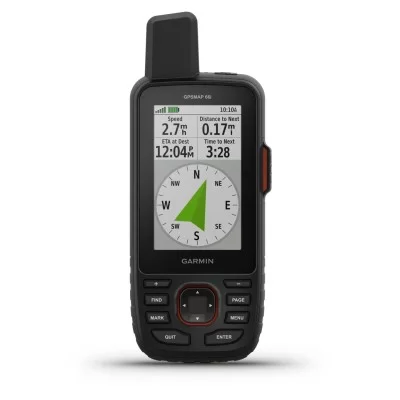
The rugged, portable GPSMAP 66i with satellite communication system combines reliable navigation options with global communication functions. It is equipped with Garmin TopoActive Europe cards and inReach technology®.
North 49 LED Light Compass, Includes: Replaceable Batteries